Map
Sightseeing Tours in Garfagnana
Itineraries car
From the Garfagnana are easily achievable, even with public transportation as a famous historical Lucca, Florence and Pisa, as well as the Riviera of Versilia and Apuan, La Spezia and the Cinque Terre.
Suggested itineraries here allows you to discover small villages and natural environments of rare beauty.
Hiking tours
The network of hiking in the Serchio Valley offers many opportunities clearly marked by CAI and territorial entities.
Here we suggest some paths of the most popular inviting you to discover all the other equipped with detailed maps and the right equipment to walk.
It is always advisable in any case, before facing a route, to ensure the viability of the same, on weather conditions and level of difficulty at the offices or the local information section C.A.I. garfagnanacai.it
From the Garfagnana are easily achievable, even with public transportation as a famous historical Lucca, Florence and Pisa, as well as the Riviera of Versilia and Apuan, La Spezia and the Cinque Terre.
Suggested itineraries here allows you to discover small villages and natural environments of rare beauty.
-
Media Valle del Serchio.
In this area you can visit historical towns like Coreglia Antelminelli, with the Museum of Plaster statues, Ghivizzano castle, the spa town of Bagni di Lucca, and the famous Ponte del Diavolo in Borgo a Mozzano, but also areas of great naturalistic as the Nature Reserves of Orrido di Botri and Balzo Nero.
The Valley Pedogna reserve, however, some notable points of interest: a Vetriano, the smaller theater in the World, in Colognora of Pescaglia, the Museo del Castagno (museodelcastagno.it) and in Celle Puccini, the house-museum where the great musician, yet the child, spent his holidays;
Contacts: comitatopuccini.it, luccavirtuale.it/musei/museo-puccini, fondazionegiacomopuccini.it
The route from Pescaglia leads to Fabbriche di Vallico can visit some of ironworks, still active, as Galgani ironworks, one of Aiola, or that of Gragliana.
The hammers operated by water molds, even today, the iron as well as in past centuries, making agricultural tools, but also the "texts", implements necessary to cook the famous "Necci with ricotta, the "crisciolette" see Events in Garfagnana) or "focacce leve", poor cooking dishes peasant.
-
Gallicano - Grotta del Vento - Barga - Castelvecchio.
The Hermitage of Calomini are set out in the living rock.
A little further is the lake Trombacco, deep up the tower.
Reached the village of Fornovolasco, the road climbs through the woods and in a few minutes at the Grotta del Vento, one of the best known caves in the world.
The magical world of underground karst cavity is enclosed on three different proposals for guided tours.
Convenient paths and aerial ladders can admire stalactites and stalagmites, draperies of alabaster watercourses and groundwater. For information: grottadelvento.com.
An alternative route back to Gallicano passing by the road that reaches the cave country of Vergemoli, home town.
From Gallicano, in short we reach the medieval town of Barga: here the narrow streets paved of the old town, bordered by elegant Renaissance palaces, leading to the top of the country, where stands the imposing Romanesque cathedral and from where you have one of the most beautiful views on the chain of the Apuan Alps.
Not far from Barga, in Castelvecchio Pascoli, you can visit the House-Museum of the poet Giovanni Pascoli.
For information: Giovanni Pascoli Foundation fondazionepascoli.it.
-
Arni Valley - Isola Santa - Careggine Plateau.
Castelnuovo, with the Romanesque Cathedral and the Fortress Ariostesca is the commercial and administrative center of the valley, enlivened every Thursday since 1430, open air market of goods.
From here the main road, which leads in Versilia, along the Turrite Secca, a typical stream of Apuan side, in a deep narrow gorge.
After a few kilometers across Lake of Isola Santa, on whose shores lies the ancient village with the typical buildings roofed in stone slabs.
Continuing, the scene opens on the rocky walls of Mount Sumbra with "Marmitte of Giants", erosion features in the rock caused by the combined action of the stones and water.
In Tre Fiumi, the main road up to the tunnel Cipollaio, then reach for Forte dei Marmi and the Versilia coast along this stretch of road in the village Levigliani, you can visit the wonderful cave tourist Antro of Corchia (corchiapark.it);
if Three Rivers, however, we turn to the right you come to Arni and tunnel Monte Pelato or Passo del Vestito (Vestito: dress), a little further on, at Pian della Fioba worth visiting the Botanical Gardens "Pellegrini"
From there his gaze over the river, the Carrara marble basins to the Gulf of La Spezia and Portovenere.
After you return, just before Isola Santa, located on the left is the road that rises to the Capanne Careggine and majesty of Formica to go down to the village of Careggine place on a plateau where you can enjoy a splendid panorama.
In this district, during the winter season, you can enjoy skiing and during other seasons are beautiful trails in secular chestnut woods.
Once in Poggio is a visit to the Romanesque Church of Saint Biagio.
-
Castiglione di Garfagnana - San Pellegrino in Alpe - Pieve Fosciana.
Castelnuovo by, following the provincial road SP 72, Passo delle Radici, one encounters few kilometers after the fortified town of Castiglione Garfagnana, whose fortress, open by appointment at the ProLoco, was defended by a large walls.(Comune di castiglione di Garfagnana)
Continuing meet: Cerageto, Sassorosso station and winter sports of Casone of Profecchia to reach the Passo delle Radici (1529 m asl), where the road continues in the side of Emilia.
Going to the right you reach the small village of San Pellegrino in Alpe;
Here the landscape opens up across the valley to the plain of Lucca.
To visit the ethnographic museum "Don Luigi Pellegrini" and the shrine with the relics of saints and Peregrine White.
The route now descends towards Chiozza to return to Pieve Fosciana where worth visiting the Water Mill, still in operation, and the spring of Pr� di Lama, hot water chloride-sodium sulfate (or simply sulfurea) known to the inhabitants of the area for its therapeutic properties. [fixed residue of 5.45 grams / liter, range: 2 l / s, temperature 37 degrees Celsius].
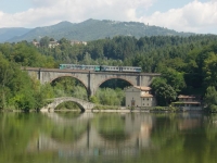
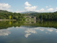
A short detour from Pieve Fosciana you reach Lake of Pontecosi, on whose shores we can spend few hours of relaxation or take part in lively feasts on water (pontecosi.it). Church of the "Madonna Addolorata".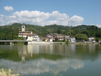
-
Orecchiella Park - Fortress Verrucole.
The Nature Reserves of the Orecchiella, are the pride of the new National Park Appennino Tosco-Emiliano.
A land of rare scenic beauty, representative of the flora and fauna of the Apennines.
Here deer, mouflon, roe deer, wild boar and wolves, as well as many species of birds, both sedentary and in hand, have found their ideal environment.
The golden eagle, which has always been on the Pania of Corfino, extending its territory to hunt up to the high peaks of Monte Prato and Monte Vecchio.
The Park Visitor Center of the Orecchiella (telephone 0583619098, fax 0583619002, e-mail: orecchiella@libero.it, e-mail: ex_asfd.lucca@corpoforestale.it), where there are also the natural museum, the projection room and the stands of typical products, is reached from Castelnuovo Garfagnana following the signs for Villa Basilica and Corfino.
Park in a "facilitated" reaches the areas of observation of animal life where one can see deer, Barbary sheep, bears and deer.
The Garden of mountain flowers, the beautiful summer blooms, and the Orto Botanico "Pania of Corfino" which fascinate, however, lovers of botany.
The tour continues to visit on the way to San Romano in Garfagnana, through the villages of Caprignana and Orzaglia, up to Verrucole where, with a short walk brings you to the beautiful fortress recently restored and are often inspired by events and medieval historical. For info Ai Canipai Hostel, aicanipai.com.
-
Lake of Vagli - Oasis of Campocatino Lipu - Lake Gramolazzo.
This route leads into the heart of the Park of the Apuan Alps, highlighting the special features.
Along the road towards Vagli Below is the artificial lake of Vagli that hides in its deep waters, the village of Fabbriche (manufacture), when the lake is emptied, for an entire summer, the old village founded by fabbri terrae Brescian, again live.
To visit the parish church of St Regulus, the Museum of Casa Abrami and the Romanesque church of S. Agostino (XI).
Going to Vagli di Sopra can be reached in short Campocatino: the ancient Alpine shepherd, lying at the edge of the large meadow at the foot of Mount Roccandagia, is now an oasis of LIPU.
An easy trail highlights the natural characteristics of this "basin" of glacial origin.
Still on foot, in about 30 minutes, you can get to the Hermitage of San Viviano.
From Campocatino you go down to Gorfigliano and Gramolazzo, where the Mount Pisanino, the highest in the Apuan chain, is reflected in the green waters of the lake.
-
Argegna - Giuncugnano - Sillano.
From Piazza al Serchio, shopping center of the upper valley, follow SR 445 for the Passo dei Carpinelli, crossing large areas planted with farro, the grain that has earned the IGP (naturalmenteitaliano.it), used in many dishes in Garfagnana.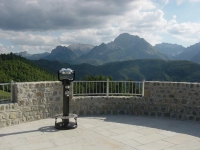
From the pass, the road descends into the valley of Lunigiana, famous for its castles, and mysterious Statue Stems. Going is the Argegna plateau, where the White Sanctuary of the Madonna della Guardia, is silhouetted on the big lawn net summit.
It then descends to Giuncugnano and from there return to the main road, following signs for Magliano and Pontecchio takes you inside the National Park of the between large areas of forests.
Affected the villages of Dalli di Sopra and Dalli di Sotto, you will reach Sillano and SP Pradarena.
A short climb to reach the historic Pass linking the Garfagnana to the province of Reggio Emilia, and closes down again on the route to Piazza Serchio.
Hiking tours
The network of hiking in the Serchio Valley offers many opportunities clearly marked by CAI and territorial entities.
Here we suggest some paths of the most popular inviting you to discover all the other equipped with detailed maps and the right equipment to walk.
It is always advisable in any case, before facing a route, to ensure the viability of the same, on weather conditions and level of difficulty at the offices or the local information section C.A.I. garfagnanacai.it
-
The ring of Panie. Mean Time 6.00 hours walk. Difficulty EE.
Starting point of movement is the location Piglionico.
Leaving the car in the vicinity of the chapel, climb the path CAI No 7 to Rifugio Rossi (TMP hours 1.15) where, with another hour of climb (CAI marker 126) in the Valley of Hell, you can reach the peak of Pania della Croce, the "queen of Apuane" (1859 meters asl).
The path descends to the mouth of hours Mosceta, and the Refuge of Freo.
From here, take the path n. 9 and, shortly after the 127, which, bypassing the Pizzo delle Saette, back to place of departure.
-
Brucciano-Sassi. Time Middle Percorrenza hours 2.30. Difficulty T.
From the parking lot of the country is rising to the right place a few steps in the path that leads to Croce di Sotto, from here a path leads to the road that connects Molazzana with the Piglionico.
The drive along an uphill stretch, via Croce di Sopra, and the junction for Forcone, reaching the mouth of Eglio.
Here you leave the paved road, turning right down the road in the direction of Eglio; you tap the little cemetery and location Carnescialle, to come in at short and he here in Sassi, where a steep paved road leads to the top of the hill (782 m.slm) dominated from the bell tower was built overlooking the valley below the Turrite, which offers one of the most beautiful scenery of the valley.
The return can be expected for the same route or follow the road in about 5 km back to Brucciano.
-
Airone 1 trail in the Orecchiella Park. Mean Time 5.00 hours walk. Difficulty E.
From the Visitor Center the trail marked in yellow and blue reaches the Rifugio Isera and the road rises to the Botanical garden.
From here down to the right direction Pruno, ancient pastoral toll from the typical covered in straw of rye.
Start now the massive return of the Pania of Cortine, reaching first on a terrace Vallone of Grottacce to go halfway up in a wild and fascinating.
Passed the spur south to arrive at the "Source of Love" and the Alpine Campaiana.
The trail, still in the woods, and then on extensive grasslands, reaches the peak of the Pania (1603 m).
Reached Saddle descend to the Mouth of the Wolves still in the vicinity of the Refuge Isera and from there to the Visitor Center.
-
Nature Trail Campocatino - Hermitage of San Viano. Mean Time to walk 2.30 hours - Difficulty E.
Easy loop trail that allows you to travel across the basin of glacial origin of Campocatino.
Traveled the first leg of the "toll" of pastors and exceeded terraces, once grown, you can reach the beech forest at the foot of the north-west of Roccandagia, which will cross up to the imposing Southeast corner.
Arrived on the dirt road that leads to Campocatino, you can now close the loop (TMP hours 1.30) or take the steep path that descends to the Hermitage of San Viano, encased in a rock wall overlooking the valley Arnetola.
-
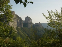
The ring of Mount Forato. Mean Time 5:00 hours walk. Difficulty E.
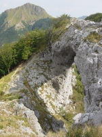
From the trail Fornovolasco CAI No 6, which rises at the mouth of Petrosciana, passing close to "Tana che Urla" and the source of Chiesaccia.
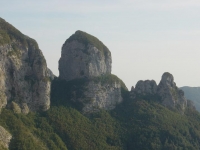
From Foce, a clear path, not marked, runs the ridge, passing near the Mont Forato (1223 m. above sea level) to reach the Foce di Valli;
the alternative is given by CAI marker 131 falls slightly in proportion but still reaches the same location at the foot of the southern edge of Pania della Croce.
Hence the sign CAI 130, touching a few scattered houses, reaches Fornovolasco.
For a shorter route from Forato descend for CAI marker 12 to meet again No 6 and finish the tour in Fornovolasco (TMP 3.30 hours).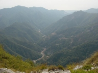
-
The ring of Monte Prato. Mean Time 5:30 hours walk. Difficulty E.
Point for this excursion is the cell that Refuge can be reached by dirt road Casone of Profecchia.
An easy climb (CAI marker 54) port on the Apennine ridge to Bocca di Massa.
From there follow the sign left CAI 00 in succession to reach the heights of Mount Cella (1942 m.), Mount Vecchio (1982 m.) and Mount Prato (2054 m asl), the highest peak of the Tuscan Apennines.
A path to the right (CAI 631) drops to the Pond Bargetana and from there to Rifugio Cesare Battisti.
The return to Bocca di Massa follows the marker CAI 633.
-
The ring of Orto di Donna. Mean walk time 4.30 hrs. Difficulty E.
Leaving the car at the end of the paved road leading to the Orto di Donna, near the Rifugio Donegani, rifugiodonegani.it, up to sign CAI 180, the Foce di Giovo, from here with a brief detour to the right until you reach the summit of Pizzo d'Uccello (recommended only for experienced hikers).
Our tour continued, however, in falsopiano for CAI marker 179 in the walls of the Cresta Garnerone and Grondilice, reaching 27 Quarry, where the road ends marble from Val Serenaia.
Here is the new refuge of the park Apuane Orto di Donna. Link: rifugialpiapuane.it.
We proceed, now, still for CAI 179 passes near the bivouac K2, to the mouth of Cardeto.
Now the path CAI 178, falls into the beech forest to return to the starting point.